Monday, 12 September 2022

TURLUNDY (Ardnamurchan Point) - SEPTEMBER 2022

This short stay away was to visit Ardnamurchan Point as part of our Six Points Tour (click to get more detail).

We stayed at a lovely AirBnB lodge at Torlundy just north of Fort William having driven through Glencoe to get here.  It was a wonderful journey which we enjoyed very much.

The first place we visited was Neptune's Staircase, the longest staircase lock in Britain, lifting boats 64 feet (20 m).  It consists of eight locks, each 180 feet (55 m) by 40 feet (12 m), and it takes boats about 90 minutes to pass through the system.  The current lock gates weigh 22 tons each, and require a team of at least three lock-keepers to operate the staircase. They usually operate to save water, they try either to fill each cut with ascending boats or with descending boats, or to allow for passing.  Prior to mechanisation, the locks were operated by capstans but now it's done by hydraulic rams and push-button control.  The base plinths of the original capstans can still be seen, although the capstans themselves have been removed.  The photo shows Ian and Tara at one of the middle locks beside a lovely yacht that was on its way north up the Great Glen to Inverness then round to Newcastle ... they live near us in Durham!

Ardnamurchan Point lies at the western end of the Ardnamurchan peninsula in Lochaber, Highland, Scotland. Ardnamurchan Lighthouse is located on the Point, just over 1 km north of Corrachadh Mòr, the most westerly point on the island of Great Britain, which is a few metres further west than the Point.  The Six Points Tour is supposed to cover the land extremes at the four compass points in Great Britain, but we've taken that to mean ACCESSIBLE compass points -  Corrachadh Mòr isn't accessible!  The nearest settlements are the crofting townships of Portuairk and Achosnich and the village of Kilchoan (5 miles/8km).

The point lies seven miles south of the island of Muck, with Eigg and Rùm a few miles further to the north. Coll is situated nine miles to the west, and Mull is five miles south. 

Not many people have heard of it, thinking that Land's End is furthest west ... but they're wrong!  You will have heard of it if you listen to the shipping forecast because it's always mentioned on there.

The point is about 75 miles from Fort William - but that takes over two and a half hours to travel.  The roads get progressively worse with the final few miles being proper "shit show fuck off" roads - single track of course but with switchback corners, blind summits, the lot!  Not a road for large camper vans (although that doesn't stop them using it!)  We went via Glenfinnan (famous for the Glenfinnan Viaduct from one of the Harry Potter films) - which was a bit disappointing from the road - and Glenuig, but came back via Strontian and the Corran Ferry.  The return route was a little shorter and quicker but there wasn't much in it.  We find routes with ferries more exciting, though.  

Strontian is worth a mention - Strontium is named after it, making it the only place in the UK with an element named after it. While natural strontium (which is mostly the isotope strontium-88) is stable, the synthetic strontium-90 is radioactive and is one of the most dangerous components of nuclear fallout, as strontium is absorbed by the body in a similar manner to calcium. Natural stable strontium, on the other hand, is not hazardous to health.  Strontium was used extensively in the manufacture of cathode ray tubes for old fashioned TVs and for extraction of sugar from sugar beet.

Anyway, back to Ardnamurchan Point ...


This is the lighthouse at the Point - you can't get much further west than this in mainland Britain.  

It's 36 metres tall (118 ft), made of pink granite and was completed in 1849 to a design by Alan Stevenson (one of the "Lighthouse Stevenson family" - not to be confused with the Lighthouse Family). It is the only lighthouse in the UK built in the Egyptian style.

And this is Ian and Tara having a well-earned coffee after the road here!  The islands behind are Coll and Acha (we think).

The place has an excellent cafe and gift shop just down the hill in the old keepers' accommodation.  It's really nicely done and has very good coffee and sandwiches.  They even had milk alternatives.

Unusually, there's no parking charges in their car park, which is really good!


As mentioned above, we came back via the Corran Ferry, one of few remaining scheduled mainland vehicle ferries in Scotland.  The route lies on one of the ancient drove routes from the Hebrides to the cattle markets in Central Scotland. Today, the ferry is a crucial link between the main A82 road with the otherwise extremely remote Morvern and Ardnamurchan peninsulas. 


Saturday, 25 June 2022

BEER - JUNE 2022


To see the sun setting at the summer solstice through the Mike Green stone circle was our aim.  Last year the event was shrouded in cloud so we missed seeing it.  This year we set out with all our fingers and toes crossed.  We stayed in Beer village again, but in a more spacious and better equipped cottage.  Everything was just as before – glorious smells of the sea, boats on the water to watch, more people this year, of course, and many opportunities to stop and pass time with them saying hello and enjoying being out and about.


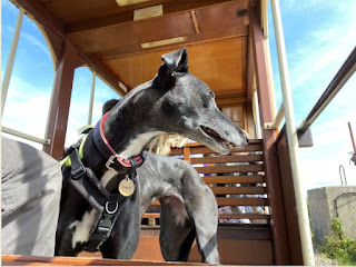
While we were in the area Ian took the opportunity of taking Tara on the little tram over the marshes at Seaton to Colyton.  A new activity for her which she enjoyed, especially watching things move passed her line of sight as the tram moved forward.  This was her first time on any public transport. After the first five minutes of not being sure, she found it great. They both enjoyed a good lunch when they arrived at the other end of the line!


This is in Colyton.  It's a lovely, rather quaint, little place with a beautiful church - there's lots more in our blog entry from last year about this place.

This picture is of a pillar box hat to commemorate the platinum jubilee of Her Majesty which was taking place around the time we visited.  We thought that it was a rather nice gesture.


Yes, we visited the land and the stone circle in good time to enjoy some good wine and some home-made elderflower cordial with crisps and biscuits.  The sun set gently in a beautiful sky and we saw everything one could wish for on this occasion.


This picture shows the moment of sunset at the Solstice.  The guy watching (sitting behind the sighting stone) can see the moment as the far stone lines up with his view.  The timing was spot-on!  Apologies for the fact that the camera was struggling getting the images in shadow AND the full midsummer sun!  Someone more adept with Photoshop could probably do something with it.


And here is the full group of "Solstice Watchers".

We also took in several  visits to the beach for coffee and buns and enjoyed the good weather.


Thursday, 2 June 2022

ALTNAHARRA MAY-JUNE 2022

We came here for our wedding anniversary.  You need to understand a little history first, so bear with us ...

Before we were married, we found a wonderful caravan site on the bank of Loch Naver in the far north of Scotland.  It was (and still is) tiny and has very few facilities - no toilet or amenities block, just a tap to get water, somewhere to empty waste and it had a few electric hookups (US call these "shore power").  No TV and there was a payphone one could use.  The nearest shops were 18 miles away.  It was wonderful!  The nearest village is Altnaharra, famous for the Altnaharra Hotel (of which more shortly) which opened in 1820 and quickly became a popular place for anglers to stay while visiting nearby lochs.

Altnaharra has a Met Office weather station, its northerly latitude and inland location mean that in winter it often features in the daily weather extremes for the United Kingdom. It is unusual in that the coldest month of the year is normally December. On 30 December 1995, the UK's lowest recorded temperature −27.2 °C (−17.0 °F) was measured here!

Anyway, back to that hotel ... we used to visit the hotel for tea and occasionally dinner, but after we were married it became a fixed tradition to travel to the caravan site for our anniversary (during the summer half term holiday) and have our anniversary dinner at the hotel.  We did that for many years,  only missing June 1994 out because Hannah was only just born ... although we did go in August that year with her at 3 months old!  We only stopped going every year when we got the caravan at Stanwix Park in 2005.

Then we realised that not only had we not been to Altnaharra for a long time, we could also afford to stay there!  So we did and that's what this post is about. 

We stayed in a hotel cottage right beside the burn after which the village is named: Allt na h-Eirbhe, Scottish Gaelic meaning Stream at the boundary wall.  In the photo left, the hotel is under the trees and the cottage is the white building.  Of course we had dinner on our anniversary evening, accompanied by Tara this time.  Although we chose from the restaurant menu, we dined in the bar (Tara was not allowed in the restaurant) which was great because the local ghillie held court for most of the evening, telling fabulous stories from the past and present and advising anyone who would listen about the best places to fish.  We listened, joined in enough to keep him going, and came away better people.  We were even able to swap stories about people we had known from our visits decades previously, that he knew or had known too.  It made our evening! 

Ghillie or gillie is an ancient Gaelic term for a person who acts as an attendant on a fishing, fly fishing, hunting, or deer stalking expedition, primarily in the Highlands.  This position still exists here and in a few other Highland locations. They are no longer manservants or attendants and do not carry Chiefs across rivers as in the distant past; today, they manage the area and guide travellers through it.

We also met one of the senior technicians from the huge Altnaharra windfarm project (72.6MW) who had come to the hotel for his dinner too. 


Altnaharra was originally called Altnaharrow (Gaelic: allt-na-charra, 'stream of the stone pillar').  Two pillars stands at the north side of the village on the A835, the photo shows one of them.  They were erected about 1850 at the instigation of the Duke of Sutherland who felt that there should be signposts at the crossroads for the guidance of travellers unfamiliar with the country.

There is an interesting (if a little unhappy) story about the pillars, which is reproduced at the bottom of this post.  Scroll down if you want to read it, but we won't subject everyone to it!


While we were here, we went across to the North East and visited John o'Groats and Dunnet Head as part of the Six Points Tour (click here for more details of that).

Many years ago, in 1955, the UK dipped its toe into nuclear power generation and the Dounreay Nuclear Power Development Establishment was formed primarily to pursue the UK Government policy of developing civil fast breeder reactor (FBR) technology.  Three nuclear reactors were built there by the UKAEA, first a materials test reactor, then two fast breeder reactor prototypes. There were also fabrication and reprocessing facilities for the materials test rigs and for fuel for the FBRs.  The reactors themselves are now closed down and the cleanup operation continues.  There used to be a visitor centre and one could go on a guided tour, but it's pretty much all gone now.  The picture (below) show the site as it is now.


Extract from the Scots Magazine June 1987 about the pillars at Altnaharra.

Altnaharra, the small township at the head of Loch Naver in Sutherland has a crossroads with two large stone pillars approximately ten feet high by three in diameter.

They were erected about 1850 at the instigation of the Duke of Sutherland who felt that there should be signposts at the crossroads for the guidance of travellers unfamiliar with the country. A ploughman was sent from Tongue Mains with two carts to collect stones for pillars from the Glencraggach Quarry at Drumholistan on the Caithness / Sutherland border and convey them to Altnaharra the following day. The stones were duly loaded on the carts, and the ploughman set out.

At that time, and for many years afterwards, the crossing of the River Halladale was by chain-ferry, a raft pulled across by winch. The ferryman took one look at the loaded carts and refused the ploughman passage on account of their weight. A considerable diversion had to be made by way of Strath Halladale.

The weather was very wet, and when he arrived at Kinbrace the burns were too full to be forded. His only recourse was to take an even longer way round by the Strath of Kildonan to the coast road, thence by Rogart to Lairg, and on to Altnaharra.

The ploughman would have travelled approximately 30 miles each day, and in bad weather without protective clothing. His journey must have been long and arduous.

Nevertheless, the stones were duly delivered to Altnaharra and the weary ploughman made for home in Tongue, where he died of pneumonia leaving a widow and a two year old son.

In 1939 the War Office ordered that the inscription on the stones be removed in case of an enemy landing. The pillars used to carry the directions:- TO TONGUE: TO DURNESS THRU STRATHMORE, and on the other:- TO GOLSPIE: TO BETTYHILL THRU STRATHNAVER.


Monday, 21 March 2022

RICHMOND, Yorkshire

We booked a couple of nights at the Richmond Travelodge.  This is at the Scotch Corner Service Area on the junction of the A1(M) and A66.  Notwithstanding the location, it's a great hotel and is surprisingly quiet ... and of course the food is available all night.  It also has a great big dog walking area.  

Being just down the A1(M), it is not far from home and this was more of an experiment than an expedition.  We wondered how Tara would get along staying away without the comfort of her crate for sleeping in at night.  In fact she did marvelously and probably slept much better than we did!  So now we know that staying away for just a few nights all in one room, with a cloth stretched over the back of a couple of chairs to make a cave for Tara, works easily!  Its a place we may well return to later in the year so we can avoid the late evening noises that come with Halloween celebrations and Bonfire night - scary stuff for a Greyhound.  

We spent the intervening day exploring Richmond itself.  It is a lovely little place with a central circle rather than a square and built on the side of a hill so it slopes quite dramatically.  It is almost entirely cobbled which makes walking an art and approaching cars sound weird.   

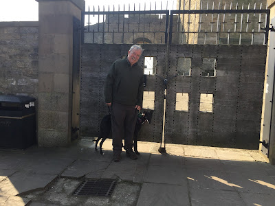
We found the gates to Richmond Castle, circled the central church and the tall monument and enjoyed coffee and buns sitting outside a lovely little cafe.  Tara embraces the street and cafe culture.


Back at the Travelodge we walked down through the nearby village (Middleton Tyas) comparing the old houses and cottages with the more modern ones and reading all the different house names that folks had used for their homes.


Saturday, 1 January 2022

THE SIX POINTS TOUR

The six-points tour covers the six key points of the mainland of Great Britain.

We visited all six of these in 2022 and 2023, three in each year.  In 2022 we visited John O'Groats, Dunnet Head and Ardnamurchan Point, while in 2023 we visited Ness Point, Land's End and Lizard Point.


  • John O'Groats 58.6373° N, 3.0689° W. This lies on Great Britain's northeastern tip, and is popular with tourists as one end of the longest distance between two inhabited points on the British mainland, with Land's End in Cornwall lying 876 miles southwest, but it is not the northernmost point of mainland Great Britain, which is the nearby Dunnet Head.  Although we visited in May, it was a great deal colder than we thought - we all wrapped up well! 

    We v
    isited on 25th May 2022.  (Also see blog entry for Altnaharra.)
 
  • Land's End.  50.0657° N, 5.7132° W.  This is a headland and tourist and holiday complex in western Cornwall, England.  It is the most westerly point of mainland England, but not the westernmost point on mainland Great Britain.  That's Ardnamurchan Point in the Scottish Highlands. Land's End's claim to fame for us is that with John O'Groats it's at the other end of the longest distance between two inhabited places.  
We visited on 4th September 2023.


  • Furthest North, Dunnet Head58.669003° N, 3.371805° E.  Also known as Easter Head, is about 11 miles west-northwest of John o' Groats.  Although it is the northernmost point on the mainland, it's a long way south of the northernmost point of Scotland - see below.
We visited on 25th May 2022.    
 
 
  • Furthest West, Ardnamurchan Point.  56.7271° N, 6.2260° W  Well, strictly speaking the furthest West is Corrachadh Mòr (56.7157° N, 6.2271° W) but you can't get there with a greyhound so for us it doesn't count and anyway there's only a few metres in it!

    We visited on 24th September 2022.
    (Also see blog entry for Torlundy.)


  • Furthest East - Ness Point - Suffolk.  52.4833° N, 1.7639° E  Also known as Lowestoft
    Ness, is the most easterly point of England, Great Britain, the United Kingdom and the British Isles. It is located near Lowestoft, Suffolk.  This is the only one of our compass points that is not only furthest on the mainland, but is also furthest East in Great Britain and the United Kingdom.
We visited on 18th April 2023. (See also blog entry for Caster-on-Sea.)
 
  • Furthest South - Lizard Point.  49.9591°N 5.2151°W.  Lizard Point (from Cornish an Lysardh 'the high court') in Cornwall is at the southern tip of the Lizard Peninsula. It is situated half-a-mile south of Lizard village and about 11 miles southeast of Helston.  Lizard Point is the most southerly point on mainland Great Britain at 49° 57' 30" N. With the exception of parts of the Isles of Scilly, it is the southernmost part of England and the wider United Kingdom.  
We visited on 6th September 2023.


For completeness, here is the full list of the extremes of the UK: 

  • Northernmost point – Out Stack, Shetland at 60°51′N 0°52′W
  • Northernmost settlement – Skaw, Unst, Shetland Islands at 60°49′N 0°47′W (we've been there too, on 3rd September 2019, but not with a greyhound because we didn't have Tara then! Also see blog entry for Shetland 2019)
  • Southernmost point – Pednathise Head, Western Rocks, Isles of Scilly at 49°51′N 6°24′W
  • Southernmost settlement – St Agnes, Isles of Scilly at 49°53′N 6°20′W
  • Westernmost point – Rockall at 57°35′N 13°41′W, which was only incorporated into Scotland in the 20th century. If Rockall is ignored, Soay, St Kilda, at 57.830°N 8.638°W is the westernmost point.
  • Westernmost settlement – Belleek, County Fermanagh at 54°28′N 8°10′W. Until 1930, the westernmost settlement was Hirta, on the island of St Kilda, but it is now abandoned; the island now has a military base, staffed during the summer months.
  • Easternmost point – Lowestoft Ness, Suffolk, at 52°29′N 1°46′E
  • Easternmost settlement – Lowestoft, Suffolk, at 52°28′N 1°45′E